Backpack the Black Canyon of the Yellowstone
44° 57' 21.5" N 110° 35' 37.1" W
Route Type: Point-to-Point
Distance: 14 miles
Trailhead: Blacktail Creek, Yellowstone National Park
Permits Required: Yes
Recommended Duration: 2 days/1 nights
Post-Hike Beer: Flathead Lake Brewing Zero Day Double IPA
The Hike:
Hiking through Black Canyon of the Yellowstone requires a 14 mile point-to-point trip through one of the most scenic and secluded canyons of Yellowstone National Park.
Logistics:
Permits are required for all backcountry camping in Yellowstone National Park and are available through the NPS website. In order to make backcountry camping reservations more than 7 days in advance of your departure date you must make an Advanced Backcountry Reservation for your backpacking permit. Advanced Reservation Applications can only be made through the mail or fax. To make a reservation you have to pay a $25 Advanced Reservation Fee in addition to a $3/person/night camping fee between Memorial Day and September 10th (outside of these dates only the Advanced Reservation Fee is required).
The hike begins at the Blacktail Creek Trailhead and ends at the Hellroaring Creek Trailhead, roughly following the flow of the Yellowstone River as it cuts through the canyon. It is recommended to at least reach campsite 1R1/1R2 as this is roughly the halfway point of the hike, however this itinerary will details the logistics of camping at site 2H3. All of the campsites along the route are scenic and in close proximity to either the Yellowstone River or Hellroaring Creek.
Note: this is a point-to-point hike and there are no shuttles within Yellowstone National Park.
Breakdown:
Day 1
There is a small parking lot at the Blacktail Creek Trailhead, however this is a portion of the park where visitors congregate to watch the bison herds as this is a popular grazing area. It is recommended to arrive early to the trailhead to prevent jockeying for parking. Once you have parked the trail begins immediately to the north of the parking lot and begins with an easy hike through the prairie for 0.7 miles before reaching a fork in the trail. To the left is the Rescue Creek Trail and to the right is Blacktail Creek Trail. Continue to the RIGHT on Blacktail. After passing the fork you will begin a 3.1 mile descent into the canyon with some steep cliffs providing glimpses into the small side canyon of Blacktail Creek before you reach the suspension bridge across the Yellowstone River. After crossing the suspension bridge stay to the right and continue on to the Yellowstone River Trail.
This section of the hike provides gently rolling terrain with frequent views of the Yellowstone River and the surrounding mountain peaks. Once you reach the 7 mile mark near the East Cottonwood Creek campsite (1R2) you will begin one of the more challenging sections of the hike. Over the next 2 miles you will gain ~800 feet with some fairly steep grades as you climb out of the canyon towards a plateau of open prairie (keep your eyes peeled for some Bison!). From here you will begin a gradual descent into the valley and at the 11.5 mile mark you will arrive at your campsite (2H3) nestled adjacent to Hellroaring Creek. Set up camp and enjoy the sunset as it dips below the mountains surrounding the valley.
Day 2
The second day begins with a crossing of Hellroaring Creek before beginning the ascent back to the rim of the canyon. Spring runoff and heavy rains can make fording Hellroaring Creek hazardous or impossible at times and an alternative bridge crossing can be found just north of campsite 2H7. After ~1.3 miles you will reach the suspension bridge across the Yellowstone River which offers great views of the rugged canyon below. Immediately after crossing the bridge you will begin a strenuous climb and after gaining 600 feet of elevation over the course of 1 mile, you will have reached the Hellroaring Trailhead and completed your hike!
Best Time to Go:
The best time to go is from May to October. Hiking during the summer months can bring high temperatures and make for a more strenuous hike.
Good to Know:
Shuttle
As previously mentioned, this is a point-to-point hike and with no shuttles within the park it is necessary to have 2 cars in order to leave one at the end (Hellroaring Trailhead) and use the other to drive to the starting point of the hike (Blacktail Creek Trailhead). If this isn’t possible and you are solo hiking you have 2 options:
Hike along Grand Loop Road back to Blacktail Creek Trailhead
Hitchhike
The distance between Hellroaring Trailhead and Blacktail Creek Trailhead via Grand Loop Road is ~8 miles, adding significant mileage to your total. Along Grand Loop Road there are no sources of water so it’s important to have plenty before departing. Always be aware of passing cars as there is not much of a shoulder area in some stretches.
An alternative to hiking the entire distance is to hitchhike. Always be cautious when accepting rides from strangers and only choose this option if you feel comfortable and do so at your own risk. When hiking this route I initially opted to hike the 8 miles between the two trailheads but developed severe blisters and made it halfway before throwing in the towel and attempting to hitchhike the remaining distance. Shortly after raising my thumb a man and his wife pulled over in their pickup and offered a ride back to the trailhead in the bed of their truck. Everything went smoothly and I arrived safely back at my car and continued on with my day. Shout out to the unnamed strangers who picked up a scraggly backpacker and saved him 4 miles of hiking with torn up feet!
Bear Safety
This hike takes place in bear country and it is important to be prepared for all possibilities. The National Park Service provides a good resource for traveling safely in bear country. The following guidelines can serve as a general safety plan:
Carry bear spray. Bear spray has been proven to be very effective in deterring bears in the chance of an encounter.
Don’t hike alone. If you are hiking alone be sure to make plenty of noise while hiking by clapping your hands, talking loudly to yourself, etc. This is especially important when traversing areas with obstructed views such as cresting hills, going around blind corners or passing through thick vegetation.
Bring a bear bag and know how to use it. There are an abundance of trees that provide good enough access for hanging a bear bag. Keep all food, toiletries, trash, etc. in the bag when not in use.
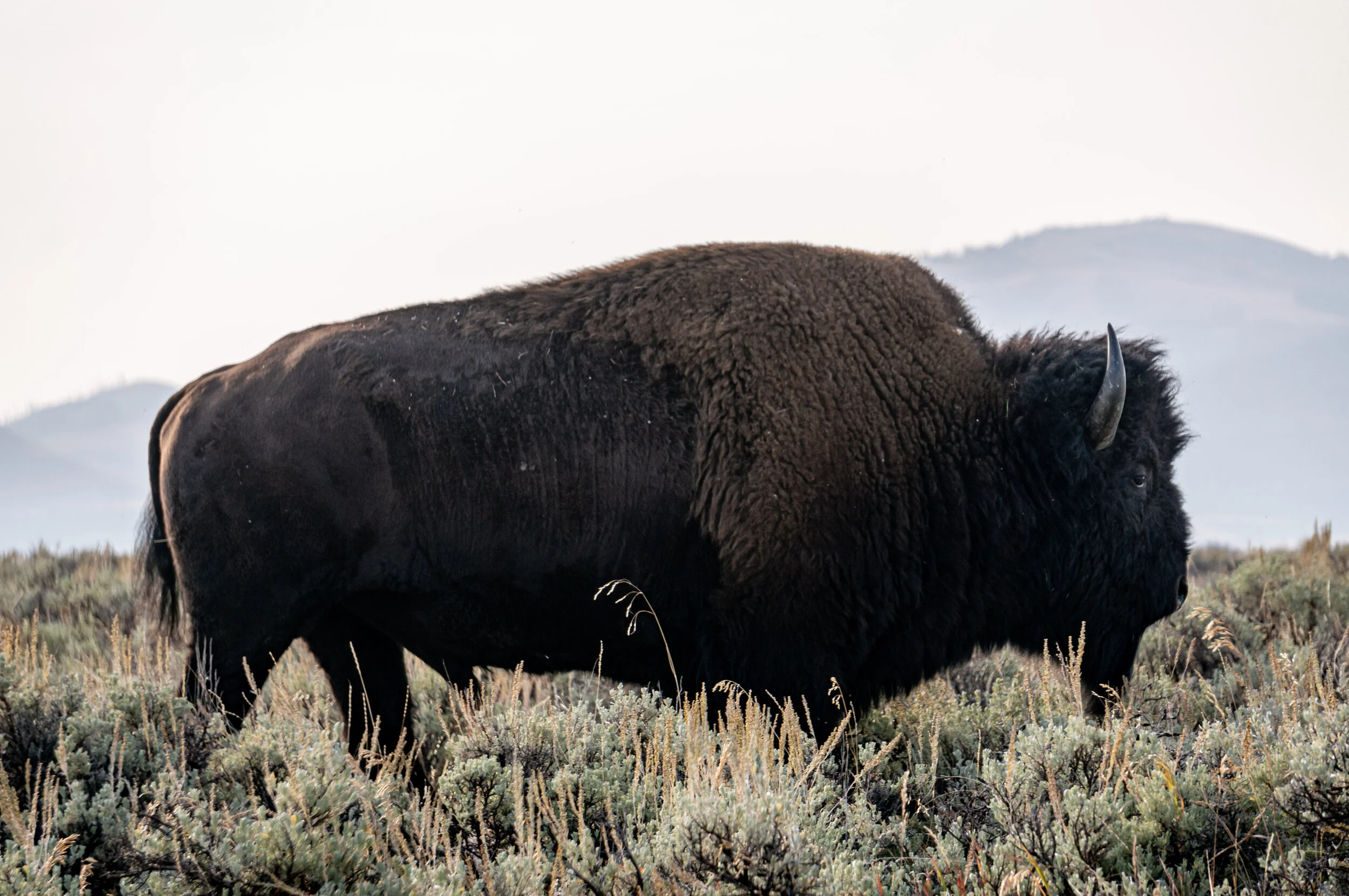
Bison Safety
Herds of Bison as well as scattered individuals are commonly found on this hike and care should be taken to keep a safe distance (25 yards) at all times. If you come across a Bison on the trail (they seem to enjoy lounging directly on the dirt trail) slowly and calmly back away. Either wait for the Bison to move on or try to safely divert off trail.